Log in
All resources
Create a design
4,774 Free Images of Atlas Map
copper engraving print
joan blaeu
british library
1667 maps
atlas maior, vol 5 (england) - joan blaeu, 1667 - bl 114.h(star).5
atlas maior, vol 6 (scotland and ireland) - joan blaeu, 1667 - bl 114.h(star).6
atlas van loon
gemeente atlas van nederland - south holland
maps from university of amsterdam special collections
atlas der neederlanden
atlas maior, vol 9 (italy) - joan blaeu, 1667 - bl 114.h(star).9
1667 maps of italy
atlas maior, vol 6 (scotland and ireland) - joan blaeu, 1667 - bl 114.h(star).6
1667 maps
atlas maior, vol 12 (america) - joan blaeu, 1667 - bl 114.h(star).12
1667 maps
atlas maior, vol 11 (asia) - joan blaeu, 1667 - bl 114.h(star).11
1667 maps
atlas maior, vol 6 (scotland and ireland) - joan blaeu, 1667 - bl 114.h(star).6
1667 maps
atlas maior, vol 6 (scotland and ireland) - joan blaeu, 1667 - bl 114.h(star).6
1667 maps
atlas maior, vol 12 (america) - joan blaeu, 1667 - bl 114.h(star).12
1667 maps
atlas maior, vol 6 (scotland and ireland) - joan blaeu, 1667 - bl 114.h(star).6
1667 maps
atlas maior, vol 6 (scotland and ireland) - joan blaeu, 1667 - bl 114.h(star).6
1667 maps
atlas maior, vol 5 (england) - joan blaeu, 1667 - bl 114.h(star).5
1660s maps of wales
1660s maps of spain
1667 maps
atlas maior, vol 6 (scotland and ireland) - joan blaeu, 1667 - bl 114.h(star).6
1667 maps
atlas maior, vol 5 (england) - joan blaeu, 1667 - bl 114.h(star).5
17th-century maps of monmouthshire
atlas maior, vol 5 (england) - joan blaeu, 1667 - bl 114.h(star).5
17th-century maps of northumberland
atlas maior, vol 11 (asia) - joan blaeu, 1667 - bl 114.h(star).11
1667 maps
atlas maior, vol 5 (england) - joan blaeu, 1667 - bl 114.h(star).5
17th-century maps of middlesex
atlas maior, vol 5 (england) - joan blaeu, 1667 - bl 114.h(star).5
17th-century maps of hertfordshire
atlas maior, vol 5 (england) - joan blaeu, 1667 - bl 114.h(star).5
17th-century maps of shropshire
atlas maior, vol 9 (italy) - joan blaeu, 1667 - bl 114.h(star).9
1667 maps of italy
atlas maior, vol 5 (england) - joan blaeu, 1667 - bl 114.h(star).5
17th-century maps of derbyshire
atlas maior, vol 6 (scotland and ireland) - joan blaeu, 1667 - bl 114.h(star).6
1667 maps
atlas maior, vol 11 (asia) - joan blaeu, 1667 - bl 114.h(star).11
1667 maps
atlas maior, vol 5 (england) - joan blaeu, 1667 - bl 114.h(star).5
17th-century maps of herefordshire
atlas maior, vol 5 (england) - joan blaeu, 1667 - bl 114.h(star).5
17th-century maps of huntingdonshire
atlas maior, vol 5 (england) - joan blaeu, 1667 - bl 114.h(star).5
17th-century maps of cambridgeshire
atlas maior, vol 5 (england) - joan blaeu, 1667 - bl 114.h(star).5
17th-century maps of nottinghamshire
atlas maior, vol 5 (england) - joan blaeu, 1667 - bl 114.h(star).5
17th-century maps of oxfordshire
atlas maior, vol 1 (northern europe, norway, and denmark) - joan blaeu, 1667 - bl 114.h(star).1
1667 maps
atlas maior, vol 12 (america) - joan blaeu, 1667 - bl 114.h(star).12
1667 maps
atlas maior, vol 5 (england) - joan blaeu, 1667 - bl 114.h(star).5
17th-century maps of somerset
atlas maior, vol 6 (scotland and ireland) - joan blaeu, 1667 - bl 114.h(star).6
1667 maps
atlas maior, vol 5 (england) - joan blaeu, 1667 - bl 114.h(star).5
old maps of the channel islands
atlas maior, vol 12 (america) - joan blaeu, 1667 - bl 114.h(star).12
1667 maps
atlas maior, vol 9 (italy) - joan blaeu, 1667 - bl 114.h(star).9
1667 maps of italy
atlas maior, vol 5 (england) - joan blaeu, 1667 - bl 114.h(star).5
17th-century maps of rutland
atlas maior, vol 3 (germany) - joan blaeu, 1667 - bl 114.h(star).3
old maps of moravia
atlas maior, vol 6 (scotland and ireland) - joan blaeu, 1667 - bl 114.h(star).6
1667 maps
atlas maior, vol 7 (france i) - joan blaeu, 1667 - bl 114.h(star).7
1667 maps
atlas maior, vol 10 (spain and africa) - joan blaeu, 1667 - bl 114.h(star).10
1667 maps
atlas maior, vol 5 (england) - joan blaeu, 1667 - bl 114.h(star).5
17th-century maps of lincolnshire
atlas maior, vol 5 (england) - joan blaeu, 1667 - bl 114.h(star).5
17th-century maps of westmorland
atlas maior, vol 5 (england) - joan blaeu, 1667 - bl 114.h(star).5
17th-century maps of essex
atlas maior, vol 6 (scotland and ireland) - joan blaeu, 1667 - bl 114.h(star).6
1667 maps
atlas maior, vol 6 (scotland and ireland) - joan blaeu, 1667 - bl 114.h(star).6
1667 maps
atlas maior, vol 4 (netherlands) - joan blaeu, 1667 - bl 114.h(star).4
1667 maps
atlas maior, vol 6 (scotland and ireland) - joan blaeu, 1667 - bl 114.h(star).6
1667 maps
atlas van loon
fort-mardyck
gemeente atlas van nederland - south holland
1860s maps of south holland
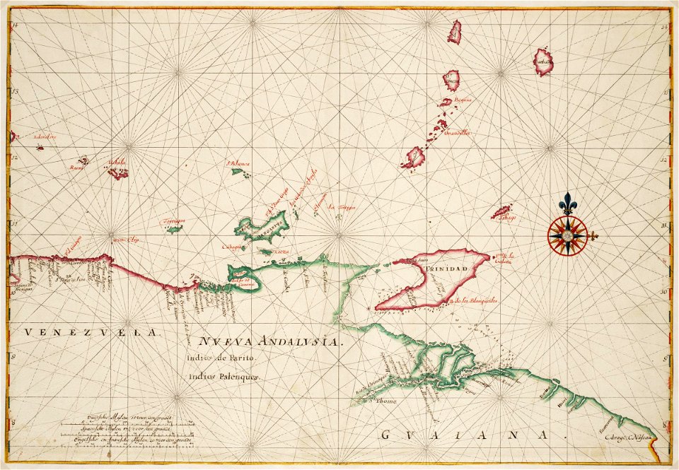
18th-century maps of the strait of magellan
1700s maps of argentina
atlas maior, vol 12 (america) - joan blaeu, 1667 - bl 114.h(star).12
1667 maps
gemeente atlas van nederland - south holland
19th-century maps of rotterdam
gemeente atlas van nederland - south holland
1860s maps of south holland
gemeente atlas van nederland - south holland
19th-century maps of rotterdam
atlas van der hagen (volume 2)
1680s maps of the netherlands
miniature speed atlas (1627) pieter van den keere
old county maps of herefordshire
theatre oft toonneel des aerdt-bodems (1571 kb)
maps of wales by humphrey llwyd
17th-century fortress plans
atlas van loon
nouvel atlas de la chine
claas condet
map of ghent by jan blaeu
atlas van loon
atlas maior, vol 6 (scotland and ireland) - joan blaeu, 1667 - bl 114.h(star).6
1667 maps
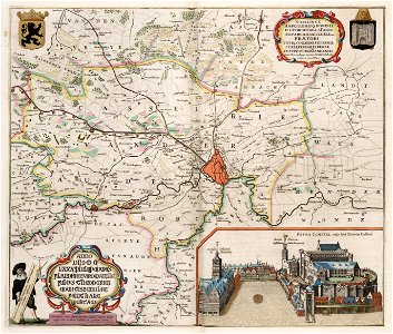
upper guelders
atlas van loon
atlas van der hagen (volume 3)
atlas van der hagen
catalan atlas, 1959 reproduction
rhumbline network
gemeente atlas van nederland - south holland
maps of krimpen aan den ijssel
maps from university of amsterdam special collections
atlas der neederlanden
atlas des anciens plans de paris by imprimerie nationale, 1880 from the musée carnavalet
maps of paris from paris musées
maps by willem and johannes blaeu
1660s maps of the americas
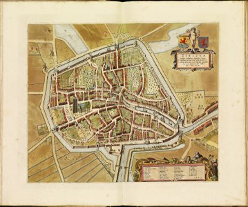
old maps of zierikzee
copper engravings
1370s maps of the balkans
catalan atlas
maps of the electorate of cologne
coats of arms on maps
17th-century maps of herefordshire
llancillo
eric (xii) of sweden (erik magnusson)
maps of the history of sweden
gemeente atlas van nederland - south holland
maps of alblasserdam
gemeente atlas van nederland - south holland
old maps of brielle
old maps of the canton of zürich
türlersee
gemeente atlas van nederland - utrecht
maps of houten
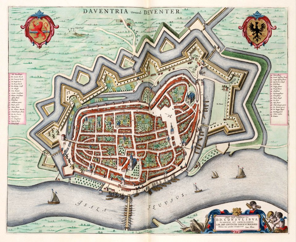
old maps of deventer
atlas van loon
old maps of schagen
maps of zijpe
atlas van der hagen (volume 4)
atlas van der hagen
maps of the west-indische compagnie
1665
17th-century maps of pomerania
coats of arms on maps
17th-century maps of pomerania
coats of arms on maps
locator maps of the harbour of rotterdam
maps of scheepvaartkwartier
old maps of utrecht (city)
atlas van loon
miniature speed atlas (1627) pieter van den keere
1620s maps of wales
miniature speed atlas (1627) pieter van den keere
old county maps of lancashire
maps of the west-indische compagnie
1665
nieuwe en beknopte hand-atlas (1754)
baronie van breda
1602 in the netherlands
siege of grave 1602
atlas maior, vol 4 (netherlands) - joan blaeu, 1667 - bl 114.h(star).4
1667 maps
maps of paris from the david rumsey historical map collection
maps of paris by caspar merian
old maps of coevorden
atlas van loon
map of ghent by jan blaeu
atlas van loon
maps from university of amsterdam special collections
atlas der neederlanden
maps from university of amsterdam special collections
atlas der neederlanden
maps from university of amsterdam special collections
atlas der neederlanden
maps from university of amsterdam special collections
atlas der neederlanden
maps from university of amsterdam special collections
atlas der neederlanden
maps from university of amsterdam special collections
atlas der neederlanden
maps from university of amsterdam special collections
atlas der neederlanden
501 - 600 of 4,774
Next page
/ 48